According to a new scientific assessment from the New Jersey Climate Change Resource Center at Rutgers University, climate change driven by human activity is increasing sea levels throughout New Jersey and raising flood risks for shoreline communities and areas along tidal rivers, marshes, and wetlands.
The publication, issued on Tuesday, spans 155 pages and represents the third installment produced by the center’s Science and Technical Advisory Panel since 2016. Commissioned by the New Jersey Department of Environmental Protection, the report incorporates contributions from 144 scientists and compiles the latest research on sea-level trends and coastal storm behavior.
- New Jersey is projected to see 2.2–3.8 feet of sea-level rise by 2100, increasing to 4.5 feet if ice-sheet melt accelerates.
- Atlantic City’s tidal records show a rise of about 1.5 feet since 1912 and a sharp increase in flood days, reaching a record 23 flood days in 2024.
- By 2050, Atlantic City is likely to experience 29–148 flood days per year, or up to 178 if ice-sheet melt accelerates, with more than 131 flood days extremely likely by 2100.
Sea-Level Outlook Through 2100
The report concludes that New Jersey is likely to see 2.2 to 3.8 feet of sea-level rise by 2100 if global carbon emissions continue at current levels. Sea level could reach 4.5 feet if ice-sheet melt in Greenland and Antarctica accelerates. The document states that it does not make recommendations for policymakers, explaining that decisions depend on the level of risk accepted by decision makers and affected communities. It advises policymakers to review projections at least every five years.
Atlantic City as the Reference Site
Atlantic City serves as the primary location for the report’s sea-level analysis. According to Robert Kopp, the Rutgers scientist who led the research and is also part of the Intergovernmental Panel on Climate Change, today’s emissions pathway is consistent with an “intermediate” scenario. Under that scenario, Atlantic City would see 2.2 to 3.8 feet of sea-level rise by 2100 without including ice-sheet loss. With ice-sheet loss factored in, the projection becomes 4.5 feet. Kopp explained that this intermediate scenario aligns with roughly 2.7°C of global warming by century’s end.
The previous edition of the advisory panel’s work, released in 2019, estimated 2 feet of sea-level rise under an intermediate scenario. The new figure is 0.2 feet higher. This updated version incorporates new emissions pathways, revised rise rates, location-specific flood-frequency projections, and summaries of expected coastal impacts.
Comments on Methodology and Uncertainty
In response to the publication, Ben Strauss, chief executive of Climate Central, a Princeton-based nonprofit, described the projections as rigorous and said the authors represent leading researchers in sea-level science. Strauss added that because the current climate and its rate of change lack historical precedent, climate science involves uncertainty, and unexpected developments remain possible.
Observed Conditions at Atlantic City
Measurements at Atlantic City show water levels rising about 1.5 feet from 1912 to 2021, averaging 1.7 inches per decade, which the report explains is approximately three times the global rate because the land surface in New Jersey is subsiding. During the 15-year span leading into 2020, tide gauges recorded roughly 4 inches of rise.
Forecasts under the intermediate-emissions pathway indicate:
- 2.9 to 4.7 inches per decade from 2040 to 2060
- Up to 5.6 inches per decade from 2080 to 2100
Flood Frequency Trends and Future Ranges
Flooding in Atlantic City has increased as sea levels climb. The city saw fewer than one flood day each year in the 1950s, compared with an average of 12 flood days annually between 2007 and 2024, and 23 days in 2024, which is the highest recorded. Estimates for 2050 range from 29 to 148 flood days per year, with a potential increase to 178 days if ice-sheet melt accelerates. By 2100, the report describes coastal flood days as “extremely likely” to surpass 131 annually.
The assessment also describes a growing frequency of “compound” flood events caused when elevated sea levels combine with storm surge, heavy precipitation, and swollen rivers.
Erosion, Wetland Capacity, and Water Supply Concerns
According to the report, continued sea-level rise will intensify erosion along the coast and may exceed the capacity of existing erosion-control efforts. It also states that many wetlands may be nearing the limit of their ability to gain sediment fast enough to keep up with future sea-level rise. Even in a low-emissions scenario, projected increases may outpace the adaptive capacity of numerous coastal wetlands.
Saltwater intrusion into groundwater and surface water supplies is expected to increase, especially in barrier island communities that rely on aquifers.
Cultural, Historical, and Economic Importance of the Jersey Shore
The Jersey Shore spans about 125 miles of Atlantic coastline and contains more than 300 square miles of tidal marshland. These coastal areas lie within the ancestral homeland of the Lenni-Lenape people, whose presence in the region extends back to 10,000 BCE, before European colonization brought disease and displacement.
The modern coastal zone supports nearly 7 million year-round residents. In 2022, businesses in Monmouth, Ocean, Atlantic, and Cape May counties received more than 50 million visitors. The region includes Atlantic City boardwalks, Island Beach State Park, the Sandy Hook Unit of the Gateway National Recreational Area, and the Edwin B. Forsythe National Wildlife Refuge. Coastal ecosystems across these areas include tidal wetlands, dunes, barrier islands, and coastal forests that support fish, shellfish, migratory birds, horseshoe crabs, and other species.
Recent Flooding and Storm Impacts
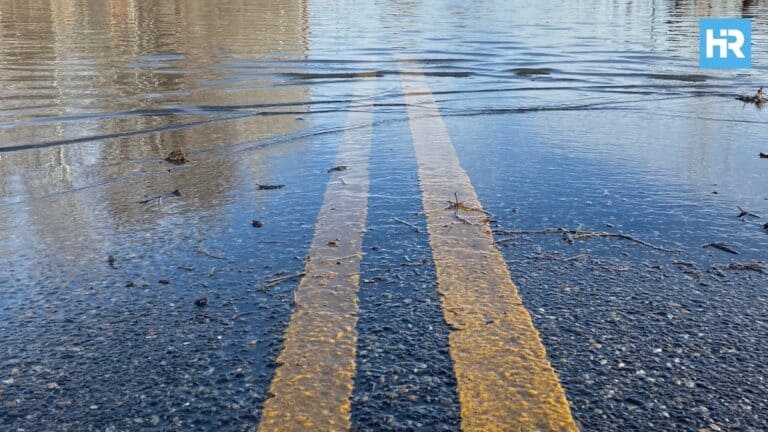
Sea-level rise has already contributed to recurring high-tide, or “sunny day,” flooding along the Jersey Shore. The region has experienced approximately 1.4 feet of sea-level rise over the past century, a rate amplified by land subsidence. Atlantic City saw 13 high-tide flooding days in 2021.
By mid-century, projections show 11 inches to 2 feet of additional rise along the New Jersey coast and 45 to 225 days of high-tide flooding per year. Under a moderate emissions scenario toward the end of the century, Atlantic City is projected to face at least 95 high-tide flooding days annually.
In October 2012, Hurricane Sandy produced 9 to 15 feet of flooding that caused widespread destruction to homes, businesses, transportation networks, and critical infrastructure, along with dozens of deaths. Tropical cyclones like Sandy are expected to become more intense, with stronger storm surge, heavier rainfall, and increased flooding hazards.
In July, the administration of Democratic Gov. Phil Murphy reversed new regulations intended to restrict development in high-risk coastal zones after developer opposition.
Current Adaptation Planning
New Jersey’s Climate Resilience Strategy, developed by the state’s Department of Environmental Protection, includes a Coastal Resilience Plan describing efforts to conserve and restore tidal marshes, manage beaches and dunes, revise coastal regulations to reflect projected sea-level rise, and address flood risk for existing buildings and infrastructure. The plan also discusses both managed and unplanned movement away from coastal zones and supports community-based resilience planning in every coastal municipality.
The state promotes living shorelines, which use natural materials such as sand, vegetation, and rock to stabilize coastlines while supporting ecological processes. At Gandys Beach, structures built to support oysters function as part of these projects and help reduce flooding and storm impacts.
Alongside these efforts, New Jersey runs programs that provide information on climate risks, expand training, and support science-based decision-making. Residents and visitors can contribute through activities such as planting dune grasses and participating in local planning.


